Tuscaloosa Severe Weather Threat for Monday
All eyes have been on the weather since storms started tearing through the Southeast early last week and today is no different.
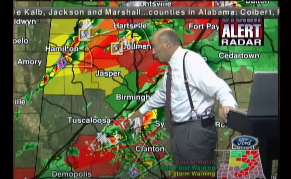
As it stand right now, it looks as if the worst part of the storm for Tuscaloosa will arrive around 11 am. On his weather blog, James Spann has given the following updates:
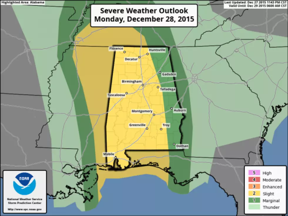
- PLACEMENT: The Storm Prediction Center has most of West and Central Alabama in the standard “slight risk” of severe weather today, with a “marginal risk” for far East Alabama. We note the higher tornado probabilities are over West Alabama. Just understand any part of Alabama could see severe storms today, but the greatest risk is west of a line from Huntsville to Geneva, in the “slight risk” area.
- TIMING: Storms will enter West Alabama as early as 8:00… then moving across the state during the day.
- MODES: The core threat will come from damaging straight line winds, however a few tornadoes are certainly possible. Hail is not especially likely. As noted above, the higher tornado probabilities are over West Alabama, especially north of I-20 and west of I-65.
- FLOODING: Much of North and Central Alabama is under a flash flood watch. Rain amounts of 1-2 inches can be expected today, and needless to say the ground is saturated. Rivers remain in flood; see this site for the latest river flood information.
- BE READY: See this post on ways to get warnings, watch our coverage, and stay safe today.
More From 92.9 WTUG