
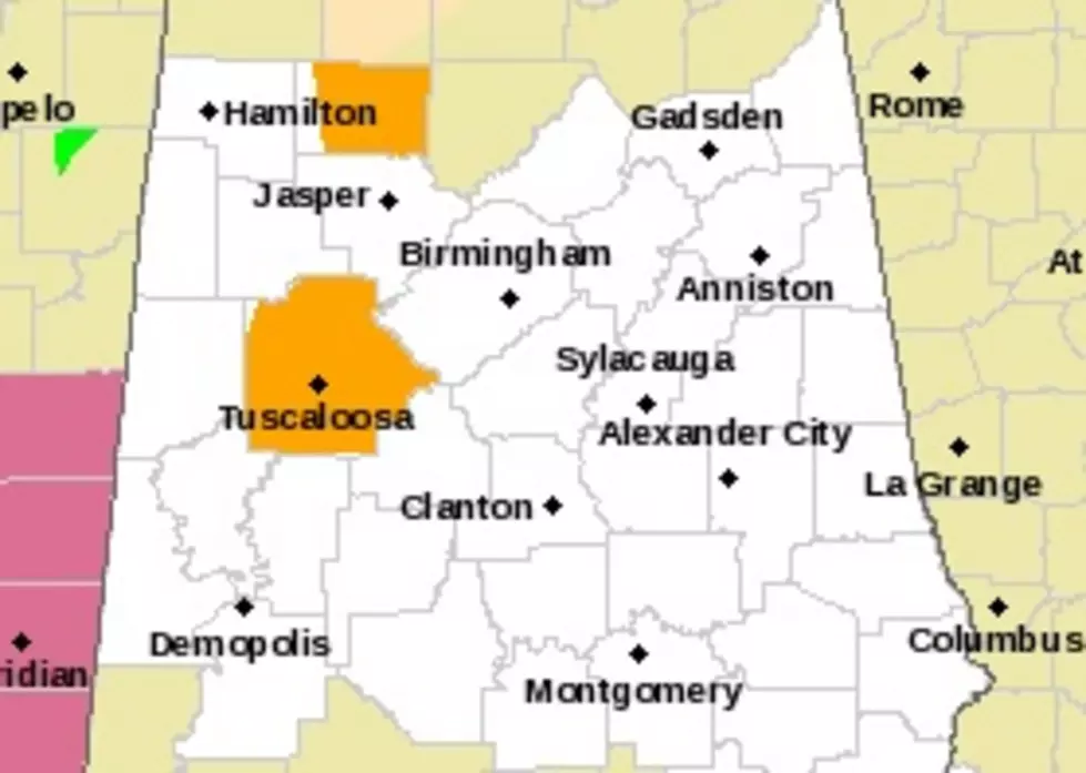
Severe Thunderstorm Warning in Effect for Tuscaloosa County Until 12:15 P.M. Today
The National Weather Service in Birmingham has issued a Severe Thunderstorm Warning in effect until 12:15 p.m. today (Thursday, May 9, 2019).
The Warning is as follows:
The National Weather Service in Birmingham has issued a

* Severe Thunderstorm Warning for...
  Tuscaloosa County in west central Alabama...

* Until 1215 PM CDT.

* At 1114 AM CDT, severe thunderstorms were located along a line
  extending from 6 miles south of Berry to near Union, moving east at
  35 mph.

  HAZARD...60 mph wind gusts.

  SOURCE...Radar indicated.

  IMPACT...Expect damage to roofs, siding, and trees.

* Locations impacted include...
  Tuscaloosa, Northport, Holt, Lake View, Brookwood, Coaling, Vance,
  Coker, Bull City, Samantha, McFarland Mall, Lake Lurleen State
  Park, Tuscaloosa Amphitheater, Tuscaloosa Regional Airport, Lake
  Wildwood, Mercedes Benz Of Alabama, Binion Creek Landing, Tannehill
  Ironworks State Park, Abernant and Shelton State Community College.

PRECAUTIONARY/PREPAREDNESS ACTIONS...

For your protection move to an interior room on the lowest floor of a
building.
More From 92.9 WTUG


