Exhausting Heat Continues, Higher Temps Next Week for West, Central Alabama
The exhausting heat continues for West and Central Alabama with heat advisories in place. Be sure you are taking precautions to stay hydrated, keep cool, stay out of the sun, and take extra steps if you work or spend time outside. Please never leave anyone left unattended in vehicles under any circumstances.
Latest Heat Advisory Information
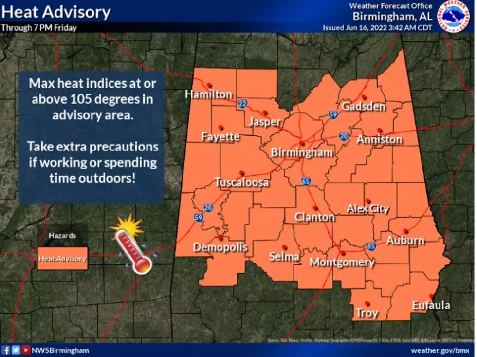
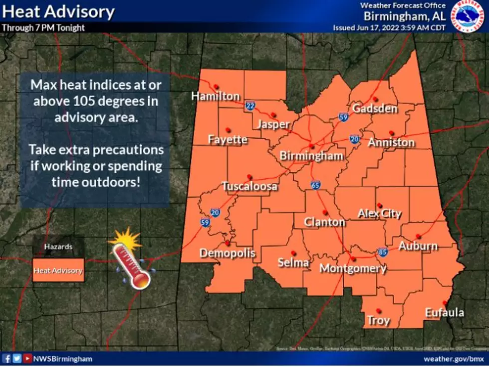
The National Weather Service in Birmingham has a “heat advisory” until Friday, June 17 at 7 p.m. for the following counties: Blount, Calhoun, Chambers, Cherokee, Clay, Cleburne, Coosa, Etowah, Fayette, Jefferson, Lamar, Lee, Marion, Randolph, Shelby, St. Clair, Talladega, Tallapoosa, Walker, and Winston.
In addition, there is a “heat advisory” until Saturday, June 18 at 7 p.m. for the following counties: Autauga, Barbour, Bibb, Bullock, Chilton, Dallas, Elmore, Greene, Hale, Lowndes, Macon, Marengo, Montgomery, Perry, Pickens, Pike, Russell, Sumter, and Tuscaloosa.
Heat Index Values
You can expect heat index values between 104 to 109 degrees in the afternoon.


Friday Outlook
James Spann, ABC 33/40, and Townsquare Media Tuscaloosa Chief Meteorologist said that can “look for a partly sunny sky today with a high in the mid to upper 90s again; widely scattered storms will form during the heat of the day ahead of a surface front. SPC maintains a "marginal risk" (level 1/5) of severe thunderstorms for areas east of a line from Waterloo to Brookwood to Troy to Abbeville. Heavier storms later today will produce strong winds and possibly some small hail; odds of any one spot getting wet this afternoon is 20-30 percent.”

What’s in Store for the Weekend?
It is predicted that there will be lower humidity values over the weekend. Spann said that “isolated storms are possible ahead of the push of drier air tomorrow over the southern counties of the state... North and Central Alabama will enjoy a sunny day with lower humidity values along with a high in the 91-95 degree range. By Sunday morning, we project lows between 57 and 64 thanks to the dry air. Sunday will be a sunny day statewide with a high generally in the low 90s.”
Temperatures Next Week
Not too much relief next week as we expect temperatures in the high 90s then midweek to rise to the 100-plus degree mark. However, due to the dry air in place the heat index temperatures will not get too extreme. But, the actual temperatures could be 100+. That’s still very hot and could lead to heat-related illnesses.
(Source) For more from the National Weather Service Birmingham, click here. Click here to follow the Facebook Page for James Spann.
Alabama Power Energy Savings Tips
Gallery Credit: Mary K
Hot Weather Safety Tips
Heat-Related Weather Terminology
LOOK: The most extreme temperatures in the history of every state
Gallery Credit: Anuradha Varanasi
More From 92.9 WTUG