Possible Strong to Severe Storms Later This Week in West, Central Alabama
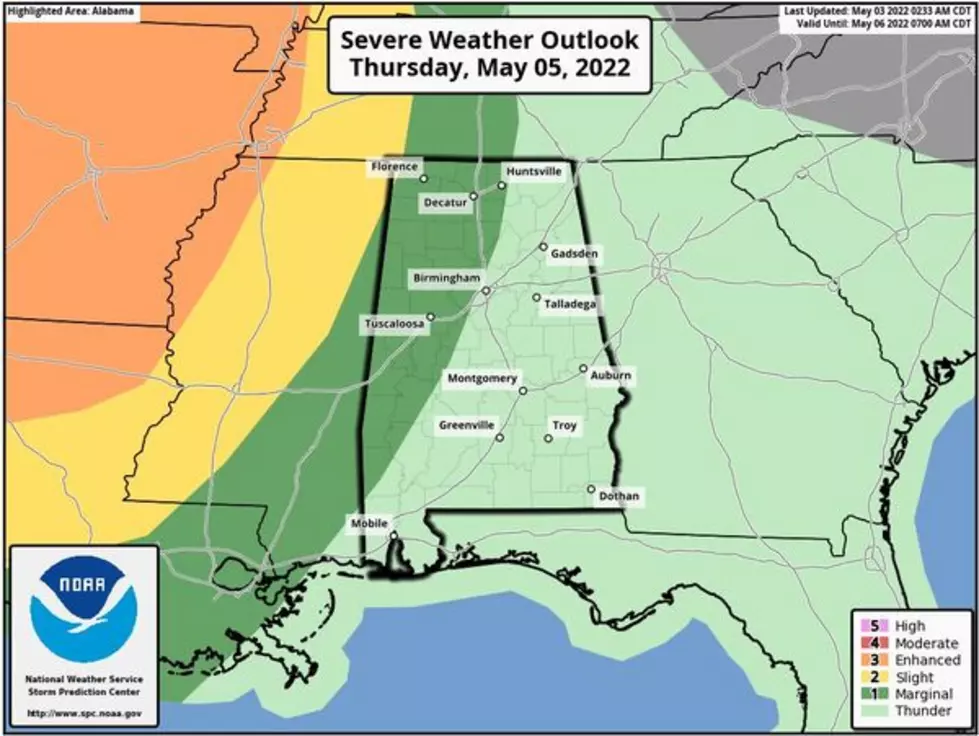
We are closely watching a storm system that will be moving across our coverage areas starting on Thursday night through Friday afternoon. The expectation is that these storms will be strong to severe in nature.

James Spann, ABC 33/40, and Townsquare Media Tuscaloosa Chief Meteorologist said that “the broad window for heavier thunderstorms will run from midnight Thursday night through 6:00 p.m. Friday; we should be able to narrow this down more tomorrow as we get within range of the high-resolution models. The main threat with the heavier storms during this period will come from strong straight-line winds and hail... the tornado threat looks low for now based on forecast wind profiles.”
National Weather Service in Birmingham Highlights
Where:
All of Central Alabama
When:
Thursday night through Friday afternoon
Threats:
Damaging winds to 60 mph
Quarter sized hail
The Storm Prediction Center (SPC) has given North and West Alabama a "marginal risk" which is level 1 out 5 for severe thunderstorms. Spann noted that this “runs through 7 am CT Friday. For now, they have not defined a risk beyond 7 am Friday due to model uncertainty.”
There will be more weather details to come as we approach Thursday.
(Source) For more from the National Weather Service Birmingham, click here. Click here to follow the Facebook Page for James Spann.
Most Dangerous Alabama Animals That Could Kill You
LOOK: Here are the pets banned in each state
LOOK: Stunning animal photos from around the world
WATCH OUT: These are the deadliest animals in the world
More From 92.9 WTUG


