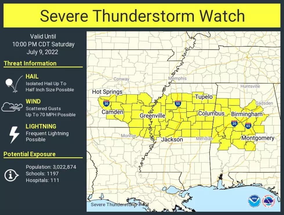
Severe Thunderstorm Watch Issued for West, Central Alabama Saturday
Update: The National Weather Center in Birmingham said "strong thunderstorms will impact portions of southern Tuscaloosa, southern Pickens, northern Perry, Greene, Hale, Bibb and northwestern Sumpter counties through 7:30 p.m."
Locations of impact include the cities of:
Tuscaloosa
Northport
Brent
Eutaw
Centreville
Greensboro
Aliceville
Carrollton
Pickensville
Holt
Moundville
Lake View
Brookwood
Coaling
Vance
Woodstock
West Blockton
Coker
Akron
Boligee
Original Story
The National Weather Service in Birmingham has issued a severe thunderstorm watch that began Saturday afternoon at 3:29 p.m and is expected to continue until 10 p.m.
The watch covers West and Central Alabama, as well as parts of Arkansas, Louisiana and Mississippi.
Primary threats include scattered, damaging winds gusts up to 70 mph.
The National Weather Service in Birmingham said "scattered thunderstorms are developing ahead of a cold front from southern Arkansas eastward across northern Mississippi into Alabama."
In the event of severe weather, we will provide updates for the counties in the Townsquare Media listening area.
Counties we cover
Bibb
Fayette
Greene
Hale
Lamar
Perry
Pickens
Sumter
Tuscaloosa
Walker
(Source) Click here to follow the Facebook Page for James Spann. For more from the National Weather Service Birmingham, click here.
Top Stories from the Tuscaloosa Thread (6/20 - 6/27)
Gallery Credit: (Stephen Dethrage | Tuscaloosa Thread)
More From 92.9 WTUG