Severe Weather Outlook for Portions of Alabama Today and Tomorrow
We are indeed in severe weather season. We are closely monitoring three potential systems for our coverage areas (today, tomorrow, and Wednesday). This information in this report will solely focus on today’s and tomorrow’s outlook.

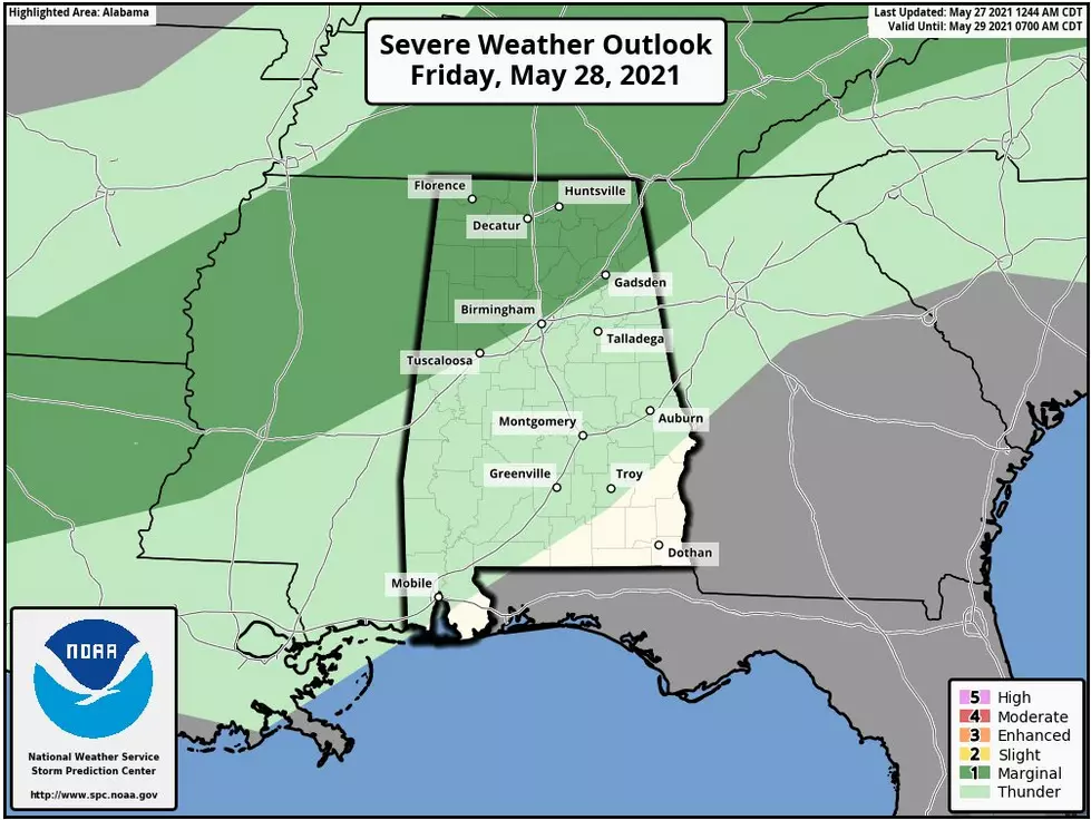
We have the potential for severe storms on Monday for the Northwestern counties in Central Alabama today. We want you to have a heads up about the possibility of significant severe weather on Wednesday for portions of Alabama.
MONDAY
According to the National Weather Service in Birmingham, for Monday, “expect shower and thunderstorm activity to increase through the day from the northwest. Some strong to severe storms will be possible with the better chances across the western and northwest counties. Damaging winds will be the primary concern, while a tornado cannot be ruled out. Hail will be a risk as well.”
The current timeline is Monday morning through the afternoon. I suggest that you are weather aware today. The NWS Birmingham noted that these storms have the potential threats of “damaging winds up to 60 mph and hail. A brief tornado cannot be ruled out.” Also, there is the potential for showers and storms in South Central Alabama for Monday night. At this time, they are not expected to be severe.
The cities that these storms could impact are Alabaster, Aliceville, Birmingham, Cullman, Decatur, Demopolis, Eutaw, Guntersville, Haleyville, Huntsville, Jasper, Marion, Oneonta, Pell City, Reform, Selma, Sweet Water, Tuscaloosa, Warrior, and York.
TUESDAY
According to the National Weather Service in Birmingham, “Severe thunderstorms are possible again early Tuesday morning through Tuesday afternoon for the southeastern two-thirds of Central Alabama. Damaging winds and hail are the main threats; however, a brief tornado cannot be ruled out.” Right now, the area of concern is for storms to develop along the I-20 corridor, then move south, and remain in the southeastern portions of Central Alabama.
(Source) Click here to follow the Facebook Page for James Spann. For more from the National Weather Service Birmingham, click here.
Things To Have Before It Rains
More From 92.9 WTUG