Alabamians Stay Weather Aware: Wednesday Night, Thursday Morning
As you know, severe weather season is in full swing in Alabama. This season for our area lasts until around May. We are constantly keeping tabs on any incoming weather systems.
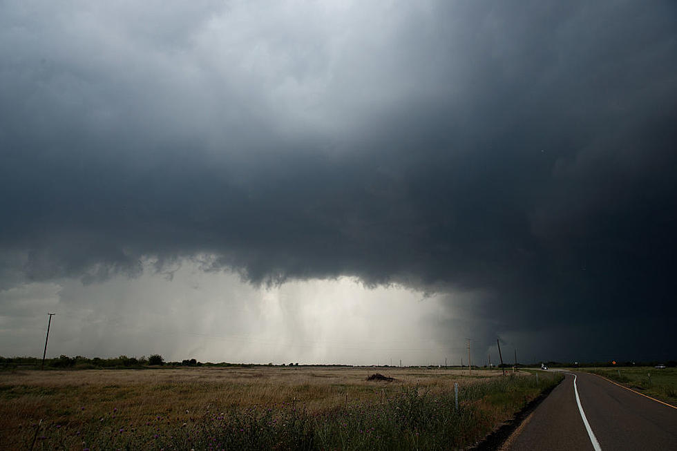
On Wednesday, April 7, 2021, we will have a partly sunny day, and you will get temperatures close to 80 degrees. As the evening progresses, there will be showers and thunderstorms that move into Alabama. This will continue into the overnight hours into Thursday morning. Please make sure you have several ways to receive weather information. Also, be sure your phones are not on silent when you go to bed.

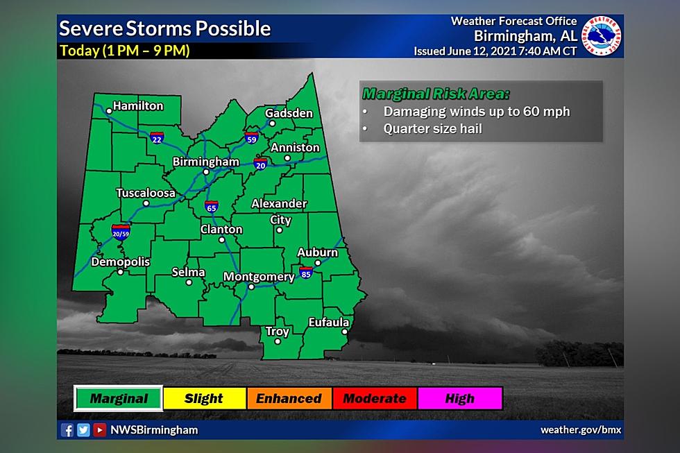
James Spann, ABC 33/40, and Townsquare Media Tuscaloosa Chief Meteorologist notes that the Storm Prediction Center” has defined a small "slight risk" area (level 2/5) for a few counties near the Mississippi border... with a "marginal risk" (level 1/5) as far east as Huntsville, Rockford, Prattville, and Mobile. This outlook is valid through 7:00 a.m. Thursday.”
The National Weather Service in Birmingham noted that “severe storms are possible across Central Alabama Wednesday night into Thursday. Adjustments to threat areas/timing are possible over the next 24 hours.” Also, the threats are damaging winds up to 60 miles per hour. Also, we can’t rule out a brief tornado.
James Spann also explained that “the storms will likely exhibit a slow weakening trend as they move into Alabama, but they will still be capable of producing strong gusty winds and small hail. An isolated, brief tornado is possible, but not likely. The heavier storms will be moving through from about midnight tomorrow night through 10:00 a.m. Thursday.”
(Source) Click here to follow the Facebook Page for James Spann. For more from the National Weather Service Birmingham, click here.
Severe Weather Terminology You Should Know
Ways to Receive Severe Weather Information
More From 92.9 WTUG