Central, West Alabama Prepares for Severe Weather Potential on Tuesday
Yesterday, Sunday, February 20, 2022, the National Weather Service in Birmingham kicked off Severe Weather Awareness Week in Alabama. Now is a great time to review your safety weather plans and make sure you have multiple ways to receive weather information. Click here for more information.
Monday Outlook
Today, Monday, February 21, 2022, as a northward moving warm front will be approaching Alabama and you will find the rain continues to increase in our area. James Spann, ABC 33/40, and Townsquare Media Tuscaloosa Chief Meteorologist mentioned that “the high will be in the 58-63 degree range over North/Central Alabama, with the 70s over the southern counties of the state south of the warm front.”
Tuesday Outlook
As always weather information can change due to many variables. It is best to check back often for any updates. We are closely monitoring this system and will issue any updates.
Temperatures should increase to the 70s throughout the Yellowhammer State on Tuesday, February 22, 2022. The National Weather Service in Birmingham said that “a cold front will move into northwest Alabama tomorrow evening then stall and linger across the area into Wednesday. Thunderstorms will develop along the front, and a few may become severe generally north and west of I-59. Heavier, slow-moving thunderstorms may also lead to localized flash flooding.”
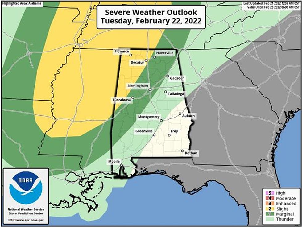
The Storm Prediction Center has issued a "slight risk" and "marginal risk" for various parts of our coverage areas. At this time the "slight risk" (level 2/5) of severe thunderstorms should take place “west of a line from Madison to Carbon Hill to Aliceville. A "marginal risk" (level 1/5) extends as far east as Fort Payne, Alabaster, and Thomasville,” according to Spann.
Tuesday Timing
This is shaping up to be an evening event. Please make sure you do not silence your phones when going to bed. Spann noted that currently “it looks like core severe weather threat will come from about 5:00 p.m. until 12 midnight.”

Areas of Concern
Severe: Generally along and west of Interstate 59.
Flooding: Along and west of Interstate 59.
Tuesday Threats
The National Weather Service in Birmingham noted the possible threats for Tuesday evening.
A tornado or two.
Isolated damaging winds up to 60 mph.
Rainfall amounts up to 2 inches, with locally higher amounts, may lead to localized flash flooding and rises along river basins.
Spann provided some more insight on the possible threats. He mentioned that the “core threat will come from strong straight-line winds tomorrow evening, although an isolated tornado or two can't be totally ruled out, especially in the "slight risk" over Northwest Alabama. Some hail is possible as well.”
(Source) Click here to follow the Facebook Page for James Spann. For more from the National Weather Service Birmingham, click here.
