Expect Multiple Days of Damaging Winds, Hail, Flooding in Alabama
Our area is starting the week with the possibility of active and unsettled weather that will last for the next several days. The weather impacting our area is part of a larger system that will impact the southeast region.

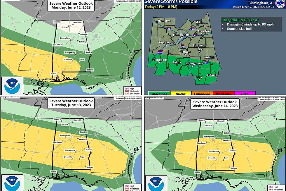
According to the National Weather Service in Birmingham, “severe thunderstorms will be possible each day, particularly for Tuesday and Wednesday. These two days will also carry the potential for flooding/flash flooding.”

Monday Outlook
James Spann, ABC 33/40, and Townsquare Media Tuscaloosa Chief Meteorologist said that “additional showers and thunderstorms will develop this afternoon, mainly over the southern half of the state.”
Monday Risk Areas
The Storm Prediction Center “maintains a "slight risk" (level 2/5) of severe storms for Southwest Alabama, with a "marginal risk" (level 1/5) as far north as Greensboro, Wetumpka, and Phenix City,” said Spann.
Monday Timeline
The activity should take place this afternoon into the evening which is roughly 2 p.m. until 8 p.m.
Monday Threats
The main threats for Monday are damaging winds and hail.

Tuesday and Wednesday Outlook
Currently, we are forecasting that the majority of the state of Alabama is either under a “slight risk” area or “marginal risk” on Tuesday and Wednesday. The main threats will be damaging wind gusts, large hail, and flooding.


We are closely monitoring the potential for severe weather to impact our area over the next several days. As this weather system develops we will provide more guidance about the severe weather threats that could impact our Townsquare Media coverage area on Tuesday and Wednesday.
(Source) For more from the National Weather Service Birmingham, click here. For more from the Storm Prediction Center, click here. To follow the Facebook Page of James Spann, click here.
WOOF: These are the most popular dog breeds in America
Gallery Credit: Sabienna Bowman
RANKED: Here Are the 63 Smartest Dog Breeds
Gallery Credit: Sabienna Bowman
LOOK: The least obedient dog breeds
More From 92.9 WTUG