Expect Showers, T-Storms, Patchy Fog, and Isolated Areas of Flooding in Central Alabama Today
It has been a pretty wet week with peeks of sunshine here and there. It will be more of the same for today, Friday, June 11, 2021. In addition, there could be showers and thunderstorms, with stronger thunderstorms producing heavy rainfall.
James Spann, ABC 33/40, and Townsquare Media Tuscaloosa Chief Meteorologist notes that the “chance of any one spot getting wet today is in the 60-70 percent range.”
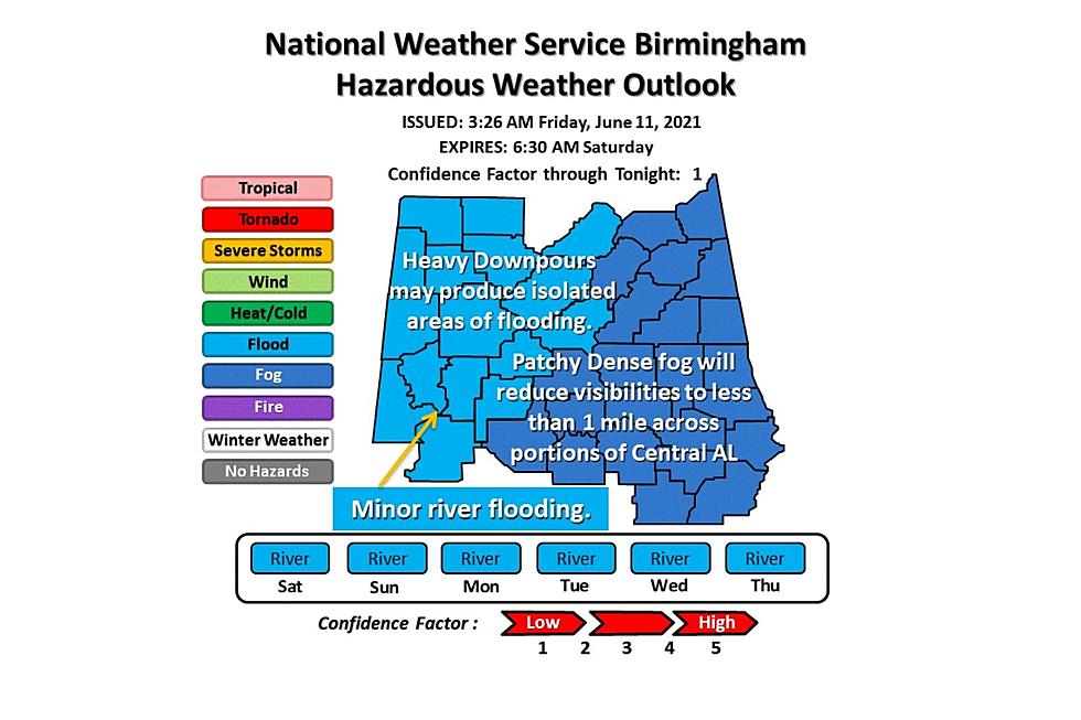
The National Weather Service in Birmingham has issued a Hazardous Weather Outlook that expires Saturday, June 12, 2021, at 6:30 am. This includes the potential that “heavy downpours may produce isolated areas of flooding,” with some areas with possible minor river flooding.

Please be careful while driving, the National Weather Service in Birmingham notes that “patchy fog could reduce visibility to less than one mile across portions of Central Alabama this morning. Take it slow out there and use your low-beam headlights. Visibility should improve by around 8 AM.”
Here are the expected new rainfall amounts for Friday, June 11, 2021.
Bibb, Lamar, Pickens County
The chance of precipitation is 80%. New rainfall amounts between three quarters and one inch possible.
Fayette, Greene, Hale, Perry, County
The chance of precipitation is 80%. New rainfall amounts between a half and three-quarters of an inch possible.
Sumter County
The chance of precipitation is 70%. New rainfall amounts of less than a tenth of an inch, except higher amounts possible in thunderstorms
Tuscaloosa County
The chance of precipitation is 80%. New rainfall amounts between 1 and 2 inches possible.
Walker County
The chance of precipitation is 80%. New rainfall amounts between a tenth and quarter of an inch, except higher amounts possible in thunderstorms.
(Source) Click here to follow the Facebook Page for James Spann. For more from the National Weather Service Birmingham, click here.
KEEP READING: Get answers to 51 of the most frequently asked weather questions...
LOOK: The most expensive weather and climate disasters in recent decades
LOOK: Here are the 50 best beach towns in America
More From 92.9 WTUG