Fast-Paced System Brings Alabama Tornado, Damaging Wind Threat
Get ready for a fast-paced system to pass through our area tomorrow morning. As this cold front makes its way across Alabama it brings the concerns of showers, thunderstorms, and non-thunderstorm wind gusts.
Storm Prediction Center Risk Levels
The SPC has placed our coverage area in a "slight risk" (level 2/5) of severe storms for the northern 2/3 of the state, with a "marginal risk" (level 1/5).
Threats
Tornadoes
Damaging winds up to 60 mph
Timing
James Spann, ABC 33/40, and Townsquare Media Tuscaloosa Chief Meteorologist said that the “line will race through the state in the 6:00-Noon time frame, and the main threat will come from strong, potentially damaging wind. An isolated tornado or two can't be ruled out, however. And, in addition to convective winds from storms, pressure gradient winds will be very strong as well.... averaging 15-30 mph with gusts to 40/45 mph in spots.”
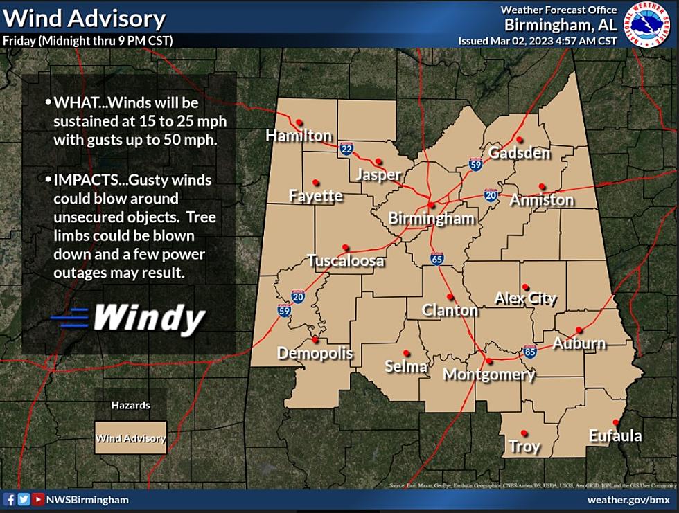
Wind Advisory for Friday
Be sure to stay aware on Friday as there is a Wind Advisory already in place. Our area could experience wind gusts up to 50 mph on Friday. Click here for the details on what to expect, timing, and counties under the advisory.
“The wind tomorrow morning will likely bring down some trees, and power outages are likely as well,” said Spann. “Be sure and pay attention to warnings tomorrow morning, including severe thunderstorm warnings. A wind advisory is in effect tomorrow for the entire state. The sky will clear tomorrow afternoon with a high in the 70s.”
(Source) For more from the National Weather Service Birmingham, click here. Click here to follow the Facebook Page for James Spann.
Top Stories from the Tuscaloosa Thread (2/13 - 2/20)
Rising Star Character Students of the Month
More From 92.9 WTUG


