Flooding Concern: Flood Watch Issued for Several Alabama Counties
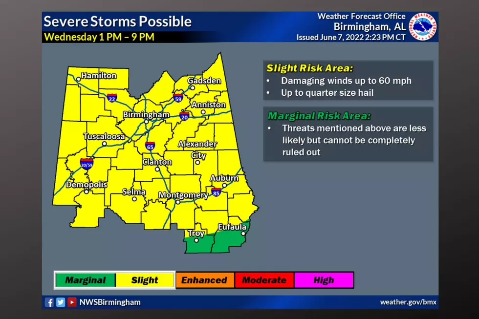
Stay weather aware for today and Friday as we expect severe weather for our area. Click here for the outlook which includes details on the threats, timeline, and regions that could be impacted. This active weather also brings the concern of flooding.
Flood Watch Info
The National Weather Service in Birmingham has issued an Areal Flood Watch for the following counties: Bibb, Blount, Calhoun, Cherokee, Chilton, Clay, Cleburne, Coosa, Etowah, Fayette, Jefferson, Marion, Randolph, Shelby, St. Clair, Talladega, Tuscaloosa, Walker, and Winston until Jun 09, 1:00 AM CDT. The counties in the Townsquare Media coverage area include Bibb, Fayette, Tuscaloosa, and Walker.
Where:
Flooding: All of central Alabama
When:
Flooding: Through 1 AM Thursday
Threat:
Localized Flash Flooding
Impacts
Excessive runoff may result in flooding of rivers, creeks, streams, and other low-lying and flood-prone locations. Flooding may occur in poor drainage and urban areas.

Additional Details from the NWS
Recent and ongoing heavy rains of two to three inches with isolated higher amounts of four to six inches have occurred across portions of Central Alabama. With more rainfall expected through tonight, some flash flooding may occur in low-lying and poor drainage areas.
James Spann, ABC 33/40, and Townsquare Media Tuscaloosa Chief Meteorologist said that “some communities have picked up over three inches of rain over the past 6 hours with this batch of storms. In addition, Spann commented, “to watch for more flooding issues with the afternoon and evening storms since the ground is now totally saturated in many places.”
Currently, there are numerous flash flooding situations unfolding in Jefferson, Shelby, and St. Clair counties. Here are some pictures and videos of the impact from James Spann's Facebook Page.
(Source) Click here to follow the Facebook Page for James Spann. For more from the National Weather Service Birmingham, click here.
LOOK: The most expensive weather and climate disasters in recent decades
Things To Have Before It Rains
KEEP READING: Get answers to 51 of the most frequently asked weather questions...
More From 92.9 WTUG


