Hazardous Weather Outlook For Today And Tonight
Hazardous Weather Outlook For Today And Tonight
Weather Update for Tuesday, November 26th
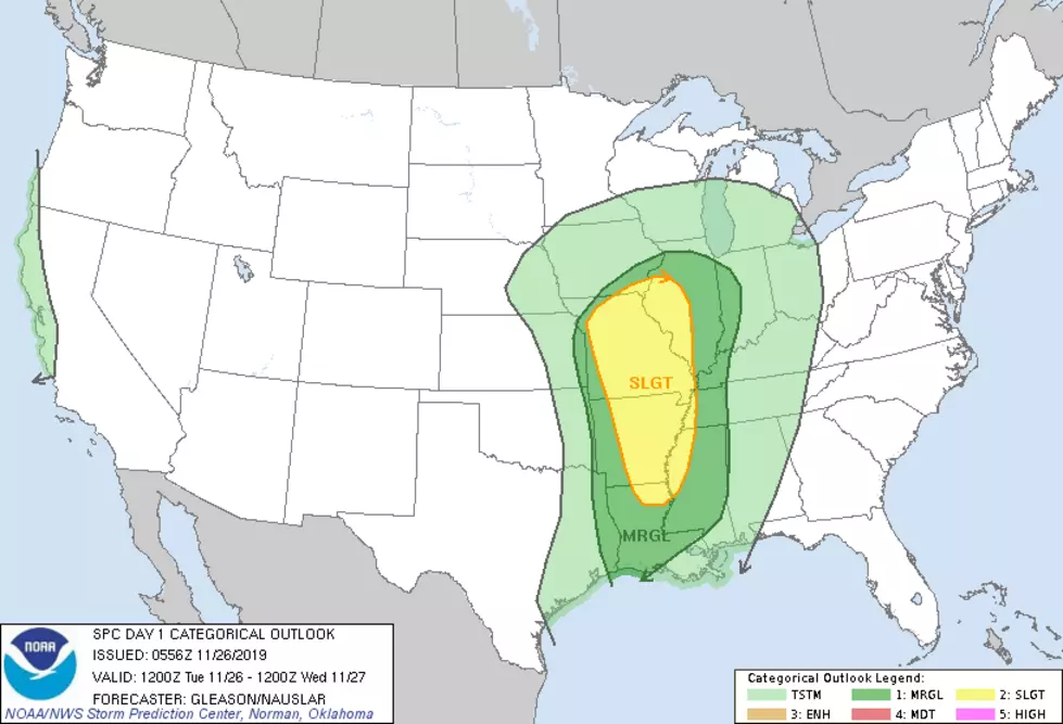
We have a hazardous weather outlook for today and tonight issued by the National Weather Service. "There is a marginal risk of severe thunderstorms after midnight tonight, lasting through 7 AM Wednesday morning. A brief tornado or isolated damaging wind gust is possible west of a Birmingham to Selma line." For the following counties: "Marion-Lamar-Fayette-Winston-Walker-Blount-Etowah-Calhoun-Cherokee-Cleburne-Pickens-Tuscaloosa-Jefferson-Shelby-St.Clair-Talladega-Clay-Randolph-Sumter-Greene-Hale-Perry-Bibb-Chilton-Coosa-Tallapoosa-Chambers-Marengo-Dallas-Autauga-Lowndes-Elmore-Montgomery-Macon-Bullock-Lee-Russell-Pike-Barbour."
Today, we will start the day with partly sunny skies; then afternoon showers are likely with a high near 69. Tonight, there will be showers with the possibility of a thunderstorm, and the low will be around 64. Also, wind gusts could get as high as 20 mph. Tomorrow, there will be showers and a possibility of a thunderstorm before noon.
@MaryKRadio – Weather Reporter
More From 92.9 WTUG