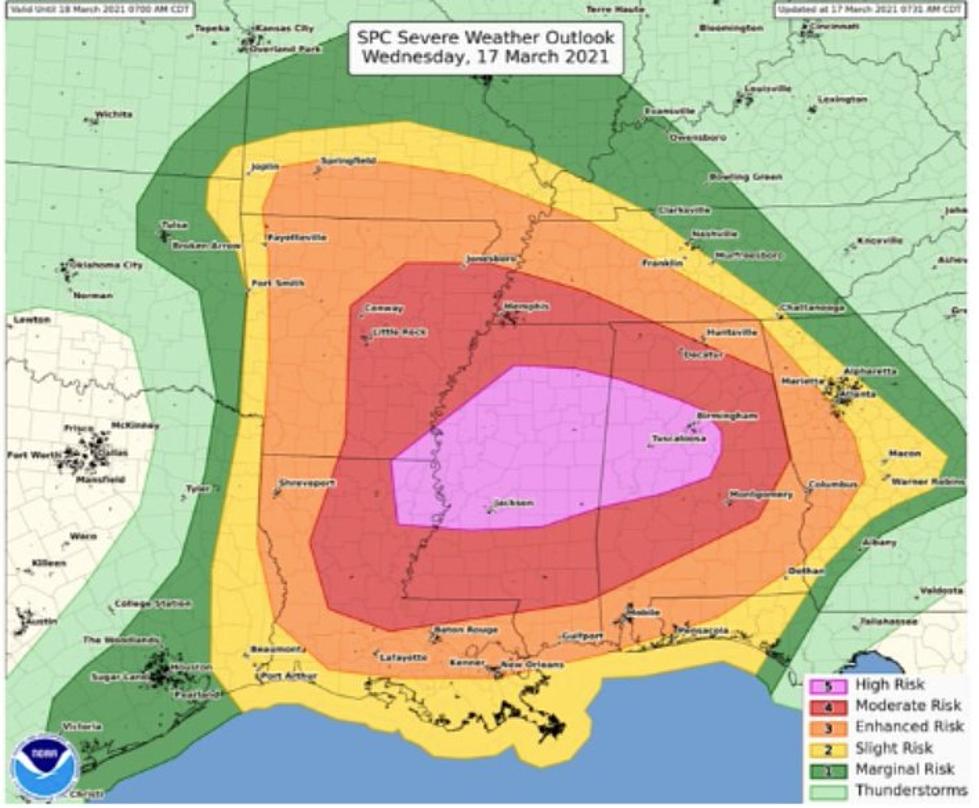
National Weather Service Issues Rare ‘High Risk’ for Tuscaloosa, Birmingham
The National Weather Service Storm Prediction Center has issued a rare "high risk" forecast area in advance of today's severe weather outbreak, and this area has been expanded to include all of Tuscaloosa.

Brian Murray of the ABC 33/40 Weather Team explains:
"High-risk Outlook issuances by the SPC are very rare. The last one was on May 20, 2019, for parts of Oklahoma and Texas. There has not been one in Alabama since April 28, 2014. On that date, a significant tornado outbreak affected much of North and Central Alabama on the 28th and 29th. There have only been four High Risk Outlook days in our state since 2010."
For a detailed look at the forecast, check out the latest Weather Xtreme video from ABC 33/30 Chief Meteorologist James Spann below.
Townsquare Media Tuscaloosa's Operation Storm Watch is brought to you by Safe-T Shelter. Visit their website here to see their selection of residential and commercial safe rooms and storm shelters. To contact a Safe-T Shelter representative, click here to visit their Facebook page.

Check out the latest radar models here:
If a tornado warning is issued in our area, Townsquare Media Tuscaloosa Operation Storm Watch will provide you with live and local team coverage, including wall-to-wall weather with James Spann.
To view the latest weather updates and information, click here.

