
Possible Severe Weather in Alabama Overnight, Early Thursday
An active and fast-moving weather system will be impacting the south with states to the west of Alabama starting on Wednesday. This storm will be moving towards the Yellowhammer State and to our area by late Wednesday night and into Thursday.
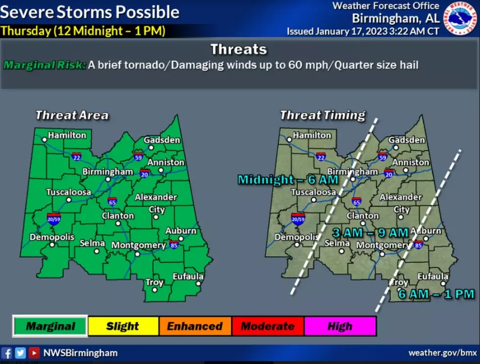
Timing
James Spann, ABC 33/40, and Townsquare Media Tuscaloosa Chief Meteorologist said that “a band of strong thunderstorms is forecast to push through Alabama late tomorrow night and early Thursday morning. SPC has placed areas north of west of Birmingham in a "marginal risk" (level 1/5) of severe storms through 6:00 a.m. Thursday, and areas south and east of Birmingham in a marginal risk after 6:00 a.m.”
"The line of strong storms will be passing through from around 1:00 a.m. until 9:00 a.m. Thursday," said Spann.
As always we encourage you to stay weather aware when there are potential severe weather threats. However, please be mindful that this system could impact our area in the late night hours when typically people are asleep. So, please pay close attention, don’t silence your phones when going to bed, and make sure you know your safe place ahead of time.

Threats
According to the National Weather Service in Birmingham the possible threats are “a brief tornado, damaging winds up to 60 mph, and quarter-sized hail.”

“There will be very little surface-based instability, and the main threat will come from strong wind gusts. We do note the atmosphere will be highly sheared, so a brief, isolated tornado can't be totally ruled out, but isn't likely. The overall severe weather threat with this event is low,” said Spann.
(Source) Click here to follow the Facebook Page for James Spann. For more from the National Weather Service Birmingham, click here.
LOOK: Here are the best small towns to live in across America
READ ON: See the States Where People Live the Longest
Gallery Credit: Hannah Lang
LOOK: Here is the richest town in each state
Gallery Credit: Meagan Drillinger
More From 92.9 WTUG


