WEATHER ALERT: Mid-February Tornadoes, Hail, Winds in Alabama
It’s mid-February and we are preparing you for not 1 but 2 rounds of severe weather this week. As of right now, the timing for round 1 is on Wednesday and round 2 should be expected on Thursday.

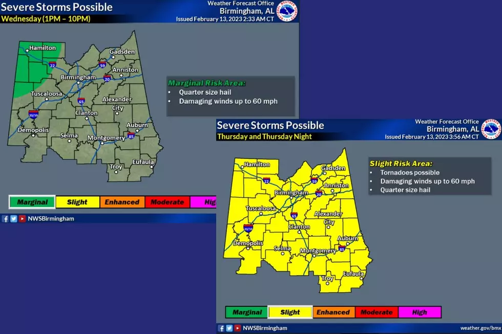
Wednesday Outlook
The National Weather Service in Birmingham said that portions of our coverage area are under a “marginal risk” for quarter-size hail and damaging winds up to 60 miles per hour. This includes a portion of Pickens, Tuscaloosa, and Walker counties. Also, this includes all of Fayette and Lamar counties.

National Weather Service in Birmingham Wednesday Highlights
Where:
Wednesday: Northwestern portions of Central Alabama.
When:
Wednesday afternoon & evening (1 PM - 10 PM)

Thursday Outlook
James Spann, ABC 33/40, and Townsquare Media Tuscaloosa Chief Meteorologist said that “conditions will favor strong to severe thunderstorms across Alabama, especially during the afternoon and evening hours. Global models suggest a decent degree of surface-based instability along with strong wind fields, but large differences exist in the placement of a surface low Thursday and its forecast evolution.”
National Weather Service in Birmingham Thursday Highlights
Where:
Thursday: All of Central Alabama.
When:
Thursday and Thursday night (timing to be refined in future updates).
Threats:
Thursday: Tornadoes, damaging winds up to 60 mph, and/or quarter-size hail.

The “SPC has all of Alabama in a severe weather risk Thursday, but there are still many questions about how the small scale features will play out, which will determine the magnitude of the event and the specific threats,” said Spann.

(Source) Click here to follow the Facebook Page for James Spann. For more from the National Weather Service Birmingham, click here.
Top Stories from the Tuscaloosa Thread (1/23 - 1/30)
Gallery Credit: (Stephen Dethrage | Tuscaloosa Thread)
12 Tuscaloosa Restaurants and Businesses that Closed in 2022
Gallery Credit: (Stephen Dethrage | Tuscaloosa Thread)
Top Stories from the Tuscaloosa Thread (6/20 - 6/27)
Gallery Credit: (Stephen Dethrage | Tuscaloosa Thread)
More From 92.9 WTUG