
Alabamians Encouraged to Take Precautions During Dangerous Heat Wave
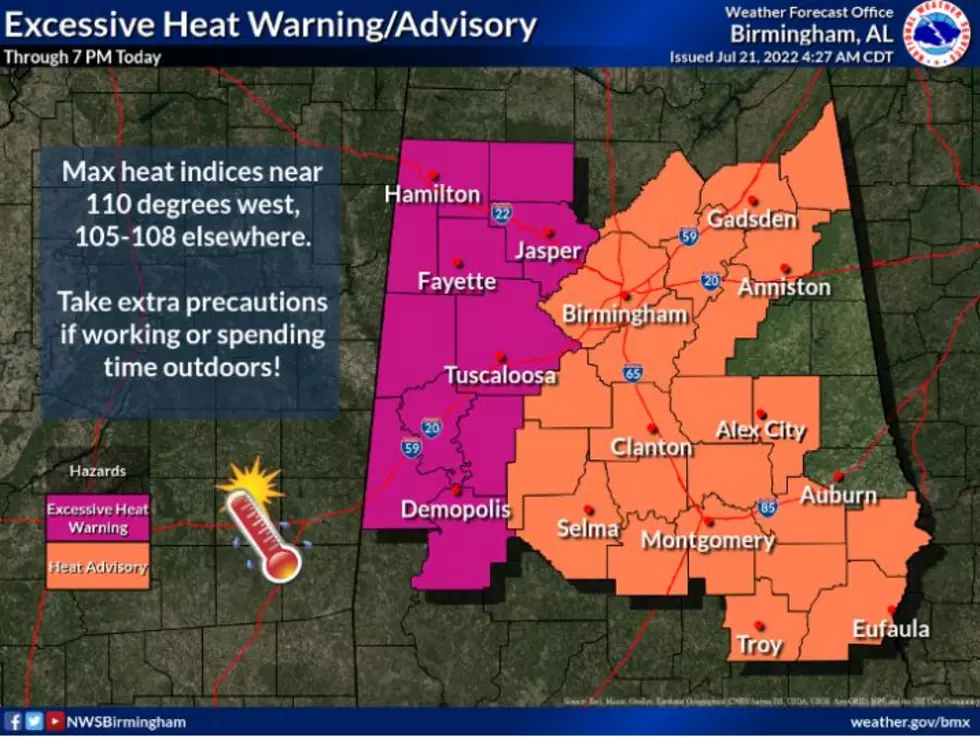
The National Weather Service in Birmingham has issued an "Excessive Heat Warning" and "Heat Advisory" in response to the dangerous temperatures and heat index value that is expected today, Thursday, July 21.
West and Central Alabama will be facing very heat index values between 105 and 110 degrees. These are very risky temperatures and could prompt heat-related illnesses. Alabamians are encouraged to take precautions during this heat wave.
HEAT STROKE IS AN EMERGENCY! CALL 9 1 1

Excessive Heat Warning until 7:00 pm
DANGEROUS CONDITIONS WITH HEAT INDEX VALUES NEAR 110
Fayette
Greene
Hale
Lamar
Marengo
Marion
Pickens
Sumter
Tuscaloosa
Walker
Winston
Heat Advisory until 7:00 pm
HEAT INDEX VALUES UP TO 105 – 107
Autauga, Bibb, Blount, Barbour, Bullock, Calhoun, Cherokee, Coosa, Chilton, Dallas, Elmore, Etowah, Jefferson, Lowndes, Montgomery, Macon, Pike, Perry, Russell, St. Clair, Shelby, Talladega, and Tallapoosa.

(Source) For more from the National Weather Service Birmingham, click here.
Hot Weather Safety Tips
LOOK: The most extreme temperatures in the history of every state
Gallery Credit: Anuradha Varanasi
Top Stories From The Tuscaloosa Thread (11/15-11/19)
Gallery Credit: (Noah Lueker | Tuscaloosa Thread)
More From 92.9 WTUG


