Days Away: Possible Tornadoes, Damaging Winds, Hail in Alabama
As severe weather season continues, we are closely monitoring conditions that could usher in severe thunderstorms across the northwest half of Central Alabama. This active weather system is projected to move into our area Friday night into Saturday ahead of a cold front.

I would like to stress to check back often as weather information about this potential storm system more than likely will be updated.
Timing
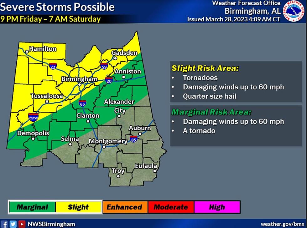
The current outlook on timing for this severe weather event is from 9 pm Friday night through 7 am Saturday morning.
Risk Areas & Levels
James Spann, ABC 33/40, and Townsquare Media Tuscaloosa Chief Meteorologist said that the “SPC has defined a risk of severe thunderstorms for areas north and west of Birmingham in their "Day 4" outlook, which runs through 7:00 a.m. Saturday.”
Possible Threats
The National Weather Service in Birmingham said that those in the possible impacted areas could experience “tornadoes, damaging winds up to 60 mph, and hail up to quarter size further to the northwest.”

(Source) For more from the National Weather Service Birmingham, click here. For more from the Storm Prediction Center, click here. To follow the Facebook Page of James Spann, click here.
Go Inside The Most Expensive Home For Sale in Montgomery County Alabama
Gallery Credit: Mary K
Most Expensive Home For Sale in Shelby County Alabama
Gallery Credit: Mary K
The Land on Alabama’s Most Expensive Home Can Fit a Theme Park
Gallery Credit: Mary K
Jefferson County’s Most Expensive Home Has Its Own Putting Green
Gallery Credit: Mary K
More From 92.9 WTUG