Possible Severe Storm Threat for Central Alabama, Wednesday Night
Possible Severe Storm Threat for Central Alabama, Wednesday Night
Alabama’s severe weather season has had a very active start. We are closely monitoring a frontal system that could enter our listening areas on Wednesday evening. This will also continue through the overnight hours into Thursday morning.
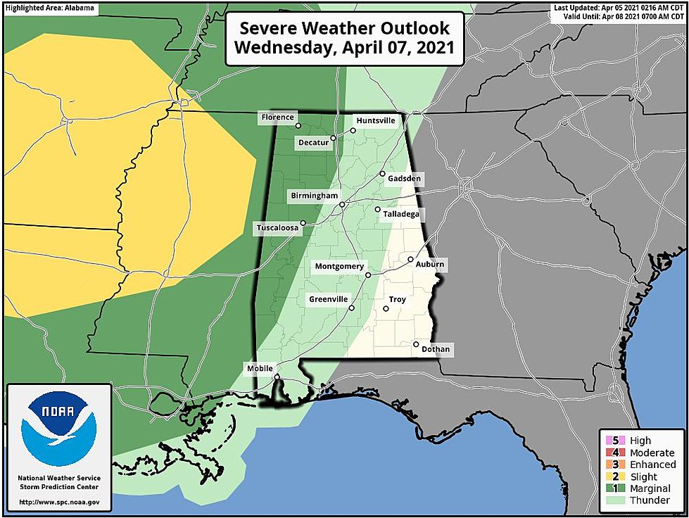
Impact Area:
Northwest half of Central. Alabama
Potential Timeline:
10:00 p.m. Wednesday until 10:00 a.m. Thursday.
Threats:
Damaging winds up to 60 mph
A brief tornado
James Spann, ABC 33/40, and Townsquare Media Tuscaloosa Chief Meteorologist noted that “Rain and storms return to the state late Wednesday night into the pre-dawn hours Thursday; SPC has defined a "marginal risk" (level 1/5) for that part of Alabama west of a line from Athens to Vance to Linden to Chatom.”
There is the potential for this system to approach our coverage areas in the late Wednesday evening, Thursday overnight, and early morning hours. This could be a typical sleeping time frame for you and your family. Please be sure that you do not have your phone and alerts silenced before you go to bed. You will need to have access to information quickly. Also, have multiple ways to receive weather information.

The severe weather season runs until May. So, please stay mindful of the weather. The National Weather Service encourages us to “make a plan, build a kit, and be prepared. I always stress that weather information could change due to many variables, like time ahead of the storm and conditions.
(Source) Click here to follow the Facebook Page for James Spann. For more from the National Weather Service Birmingham, click here.
WATCH OUT: These are the deadliest animals in the world
More From 92.9 WTUG