Prepare for Yet Another Round of Severe Weather for West, Central Alabama
The Deep South is preparing for another round of severe weather. Yes, this is the 4th week in a row that we have had severe weather in our area. We always want to give you as much notice as possible to prepare for a potential severe weather threat which is forecasted for Wednesday, April 13, 2022.

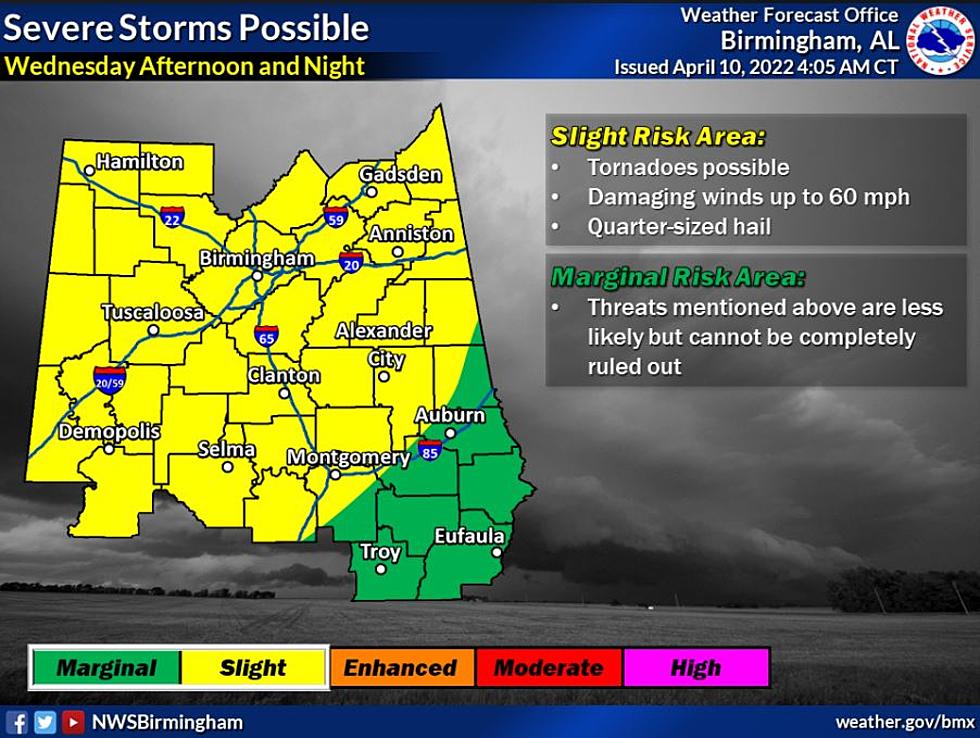
Here is the general overview of the storm system from the National Weather Service in Birmingham.
Where:
All of Central Alabama
When:
Wednesday afternoon through Wednesday night
Threats:
Tornadoes
Damaging winds up to 60 mph
Quarter-sized hail
James Spann, ABC 33/40, and Townsquare Media Tuscaloosa Chief Meteorologist said that “a more organized band of rain and storms will push into the state late Wednesday and Wednesday night ahead of a cold front. SPC has much of the state in a severe weather risk in their "Day 4" outlook... for now, the main threat most likely will come from strong winds, with an outside risk of a tornado. The higher severe weather probabilities this week will be west of Alabama, where dynamic forcing and instability values will be considerably higher.”
There is a concern for some flash flooding across the area. The Weather Channel noted that “given the recent rounds of severe weather across the South, there is at least some threat of flash flooding where heavy rain occurs. Some spots may pick up 2-4" of rain in the upcoming work week.”
(Source) Click here to follow the Facebook Page for James Spann. For more from the National Weather Service Birmingham, click here. Click here for more from the Weather Channel.
LOOK: Here are the best small towns to live in across America
LOOK: Here are the 50 best beach towns in America
LOOK: Here is the richest town in each state
More From 92.9 WTUG


