West, Central Alabama Face More Possible Severe Weather This Week
As we move closer to Wednesday the severe weather threat will become more defined for our coverage area. Currently, the timing and threat areas have been adjusted from previous forecasts.
The Weather Channel commented that “this could be the fourth severe weather outbreak in as many weeks. About 1,100 reports of severe weather have been received by the NWS in the three outbreaks since March 21.”
A cold front will move across the state and bring along with it rain and storms Wednesday night, late-night, and even into the early hours of Thursday. We are closely monitoring this potential weather scenario because the level of impact is dependent (at this time) on the early Wednesday morning activity that could shape the intensity of the system in our area.
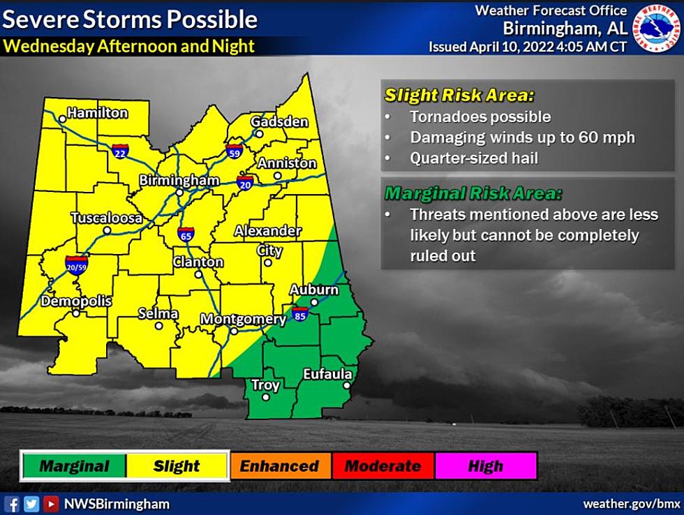
Here is an overview for Wednesday, April 13, 2022, from the National Weather Service in Birmingham.
Where:
All of Central Alabama
When:
Wednesday Night (possibly into early Thursday morning far east)
Threats:
Tornadoes
Damaging straight-line winds from 60 to 70mph (Higher risk of damaging winds west and northwest)
Quarter-sized hail
For me in the weather field, nighttime weather events worry me. Evening time is when you are not as aware and more relaxed. Since this has become more of a nighttime event, please be sure you do not silence your phones when you get home or at bedtime. It will be important to receive alerts that need to wake you up.

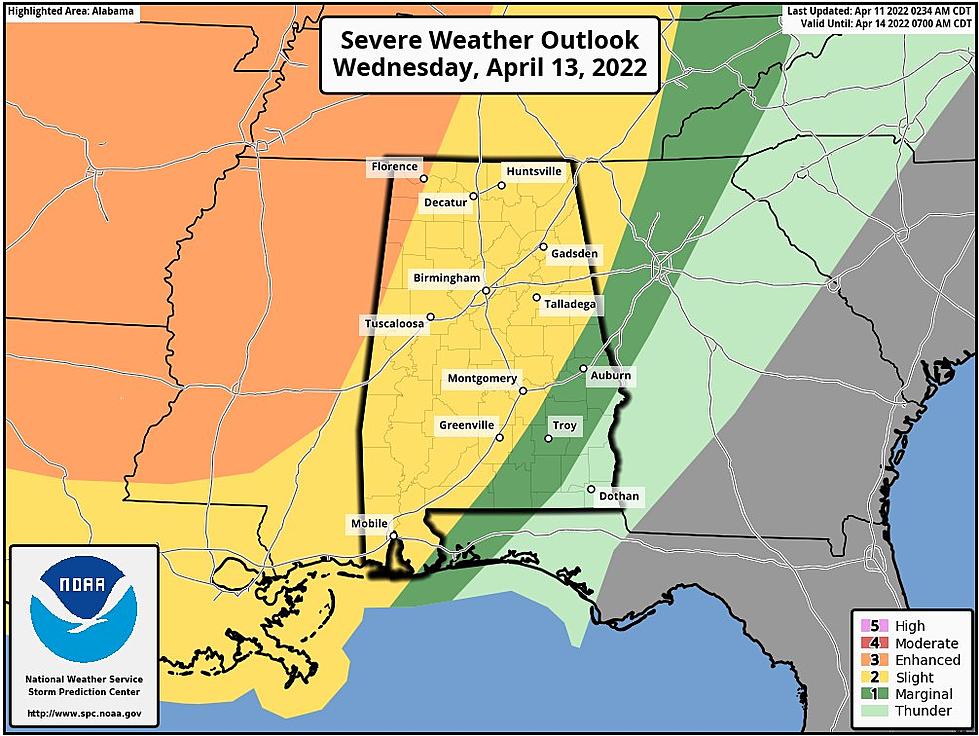
Storm Prediction Center Risk Areas and Levels
Level 3 out of 5 - "Enhanced Risk" for the Northwest corner of the state
Level 2 out of 5 - "Slight Risk" for most of Alabama
Level 1 out of 5 - "Marginal Risk” for the Southeast counties
James Spann, ABC 33/40, and Townsquare Media Tuscaloosa Chief Meteorologist said that “the line of storms will enter Northwest Alabama around midnight Wednesday night, and will pass through the state during the early morning hours Thursday. For most places, the line will be moving through late Wednesday night between midnight and 7:00 a.m. Thursday. The core threat will come from strong, potentially damaging straight-line winds. With the surface low well to the north (near the Canadian border), shear values won't be especially high, and the tornado threat for now looks low. But, as always in a case like this, you can't rule out an isolated tornado in the line.”
Now is a great time to be sure you understand what county you live in and what section of the county. Here is a great map to look over.
(Source) Click here for more from the Weather Channel. For more from the National Weather Service Birmingham, click here. Click here to follow the Facebook Page for James Spann. Click here for more from the SPC.
LOOK: The least obedient dog breeds
RANKED: Here Are the 63 Smartest Dog Breeds
RANKED: Here Are the 63 Smartest Dog Breeds
LOOK: Here Are 30 Foods That Are Poisonous to Dogs
LOOK: Here are the pets banned in each state
More From 92.9 WTUG


