Marco has Weakened, but Laura Slowly Gains Strength
Marco has Weakened, but Laura Slowly Gains Strength

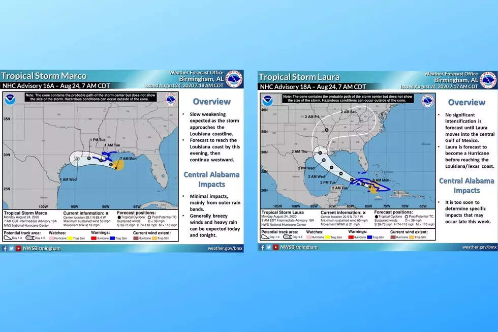
Marco Update
Marco was downgraded back to Tropical Storm earlier today due to the weakening of the system. It is expected that Marco will bring to the coastlines of the Florida Panhandle, Alabama, Mississippi and Louisiana winds, heavy rainfall, and storm surge. As of right now, the thoughts are that Marco will become more west in its tracking, and the center will come near the coast of Louisiana.
Possible impacts to Central Alabama from Marco
According to that National Weather Service Birmingham, impacts from Marco:
- Minimal Impacts, mainly from outer rain bands.
- Generally, breezy winds and heavy rain can be expected today and tonight
Laura Update
As of right now, the prediction is that Laura will be upgraded to a Hurricane status on Tuesday as it continues to have a slow strengthening. Laura is on track to move into the southeastern Gulf of Mexico later tonight into Tuesday morning. Also, the tropical storm is tracking towards the Texas and Louisiana coasts by the middle of the week. I still like to stress that there many variables that could change Laura’s trajectory.
Possible impacts to Central Alabama from Laura
According to that National Weather Service Birmingham, impacts from Laura:
- It is too soon to determine specific impacts that may occur late this week.
I will continue to stay up to date on the systems and bring you updates when needed.
(Source) For more from the Facebook Page of the National Weather Service Birmingham, click here.
Things To Have Before It Rains
More From 92.9 WTUG